Showing posts with label GA. Show all posts

Thursday, August 22, 2013

Macedonia, GA

Macedonia is an unincorporated community along Georgia Highway 20 in eastern Cherokee County, Georgia, United States approximately 6 miles east of the county seat, Canton, Georgia. The center of Macedonia is approximately 45 miles north of Atlanta via I-75/I-575, or 35 miles via GA 400. Straight-line distance indicates mileage of 31 miles from the center of downtown Atlanta.

One theory as to how the community got its name is from Macedonia Baptist Church which was established in the late 1870's; from there an elementary school along Dock Lathem Trail (now closed) was also called Macedonia. Macedonia also had a second elementary school along Cokers Chapel Road prior to the present Macedonia Elementary School built in 1956. Macedonia Elementary underwent a significant renovation and a new schoolhouse was built in 1997 to accommodate the explosive growth.

Economy

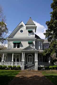
Since the early 1990s, the Macedonia community has become a hotbed of suburban growth with a mix of residential and commercial development. One major residential development is the Woodmont Country Club, which has over 900 houses and the community's first golf course (privately owned).

With Macedonia having a largely rural history, most of the older residents do not live in a subdivision; some residents still own vast amounts of farmland. Since 2002, many commercial developments have been built such as Kroger grocery store, Wells Fargo Bank, McDonald's Restaurant, Waffle House, and several other outparcels. Walgreens Drug Store has also expressed interest in the area. Macedonia has a convenience store that used to also be used as a very small grocery store before Kroger was built.

Macedonia Foods has been in operation since the 1980s but has since been bought out by BP and is now primarily a gas station. Prior to 2002, the closest significant commercial development was in the city of Canton.

Transportation

Macedonia is accessible from Exit 19 on Interstate 575 or Exits 7 though 11 on Georgia Highway 400. Its main intersection is with East Cherokee Drive, which runs from south of Ball Ground to north of Woodstock along a high-growth corridor.

Georgia Highway 20 is a very heavily traveled east-west corridor in extreme suburban Atlanta. Traffic counts from the GDOT indicate traffic can increase to 25,000 vehicles per day. With the route being exclusively a two-lane road from I-575 to well into Forsyth County, the Georgia Department of Transportation (GDOT) has indications to widen the highway within a "long-range" plan. In January 2011, construction had begun on truck climbing lanes from Union Hill Road to SR 369. With the intersection of East Cherokee Drive and SR 20 being encompassed by a cemetery and church, it's rumored that a bypass will be built to the north of the current intersection since the DOT cannot destroy churches or cemeteries. Macedonia was also discussed as being a part of the now supposedly defunct Northern Arc highway plan. The Northern Arc was discussed in the late 1990s and early 2000s as a bypass for I-285 in Atlanta and Highway 20 in Bartow, Cherokee, and Forsyth Counties.

The Northern Arc was to run just north of Highway 20, having a major interchange with I-75 in Bartow County, I-575 in Cherokee County, GA 400 in Forsyth County, and I-85 in Gwinnett County.

The highway was part of a more expanded plan to have an outer perimeter highway around the exurbs of Atlanta.
Macedonia is split between the zip codes of 30107 (Ball Ground) and 30114, 30115 (Canton). Any area lying north of Georgia Highway 20 is regarded as Ball Ground and anything lying south or along the highway is in the Canton zip code.

Education

There are several schools serving the community, including Macedonia Elementary School (built 1956) , Creekland Middle School (built 2004), and Creekview High School.

Religion

There are three active churches in the area: Macedonia Baptist (est. 1876), Morning Star Church (est. 2002), and a Presbyterian Church (est. 2011)

External Links

Creekview High School
Northern Arc
Cherokee County

Source: Internet

Wednesday, August 21, 2013

Ball Ground, GA

Motto: "Where we roll out the red carpet, not the red tape"

Ball Ground is a city in Cherokee County, Georgia, United States. As of the 2010 census, the city had a population of 1,433. Ball Ground is at the northernmost end of Georgia Interstate 575, north of Canton at exit 20 on I-575, and ending seven miles (11 km) north at exit 27.

History

Some records indicate Ball Ground was originally named Battle Ground on early maps. The town is located near fields that the Cherokee Indians used to play stick ball, a rough game similar to modern lacrosse. Local legend, as well as a Georgia Government website, indicate that Ball Ground derives its name from the game played by the Cherokee Indians native to Cherokee County. The large fields and abundance of freshwater streams made Ball Ground an alluring place for the large gatherings of Native Americans because the ball game required large, flat fields, and there were plenty of natural resources to support large groups of people. When settlers entered the area, the streams and fields attracted farmers, who dammed up creeks to create numerous man-made ponds and lakes. Most ponds and lakes still exist today, and Ball Ground still has a predominantly agriculture-based economy.
The community was incorporated on January 1, 1882.


Ball Ground, in the northern part of Cherokee County, Georgia, is a community of almost 1,000 residents. Two and one-half miles to the east of the town, near the confluence of Long-Swamp Creek and the Etowah River, is the traditional site of the Battle of Taliwa, the most decisive battle of the war between Cherokee and Creek Indians in the 18th century. Cherokee history tells that the conflict over territory was determined by a stickball game here. Before the railroad came through in 1882, the city was almost purely agricultural, consisting of two country stores and a few dwellings. After the railroad, the town grew as a result of the marble-working industry.

Economy

In the 21st century, Ball Ground is growing as businesses and homeowners are pushing into the North Georgia mountains along the I-575 corridor. It boasts a number of new subdivisions and light industry.

Transportation

The Cherokee County Airport is located between Ball Ground and Canton.
Interstate 575 goes through Cobb and Cherokee Counties and ends in Ball Ground.

Tropical Storm Lee

On September 5, 2011, due to Tropical Storm Lee, an EF1 tornado caused damage throughout the city's business and residential areas. No deaths or serious injuries were reported. Striking much of Cherokee County, including Woodstock, Holly Springs and Canton, the storms struck a 24-mile path. Electricity was restored after 2 days and residents continued clean-up for numerous days.

External links


Monday, August 19, 2013

Clayton, GA

undefined
View of Clayton from Black Rock Mountain State Park

Clayton is a city in Rabun County, Georgia, United States. The population was 2,019 at the 2000 census. The city is the county seat of Rabun County and is located in the Blue Ridge Mountains.

History

The area that would eventually become Clayton was called the Dividings because it sat at the intersection of three important Cherokee trails. Explorer and naturalist William Bartram came through the Dividings in May, 1775 while exploring what would later become Rabun County. Much later, after Clayton had grown to include the Dividings, two of the old Cherokee trails became the main roads for Clayton and the county: U.S. 441 and U.S. 76.

Clayton was incorporated December 13, 1823 as Claytonville but the name was later shortened to Clayton. The city was named after a prominent jurist and congressman, Judge Augustin S. Clayton who served in both the Georgia House of Representatives and Georgia Senate before becoming as a representative of Georgia in the United States House of Representatives from 1831–1835. In 1824, 67 acres (270,000 m2) were purchased from Solomon Beck for $150 and a site for a courthouse and the surrounding streets was laid out.

In 1904, the Tallulah Falls Railway was completed to Clayton from Cornelia, Georgia and was later extended to Franklin, North Carolina by 1907. Clayton has had public water and sanitary sewer service since the 1920s. Initially, the water supply was two springs on nearby Buzzard Roost Mountain, but today Clayton uses Lake Rabun as its water supply.

In 1936, Clayton recorded 30.0 inches (760 mm) of total snowfall making that year the snowiest year in the city. The recorded snowfall in Clayton in 1936 is also a state record.
Part of Disney's Old Yeller was shot here in 1957.

Geography

Clayton is located at 34°52′40″N 83°24′6″W (34.877788, -83.401691) and is situated at the southern base of 3,640-foot Black Rock Mountain. Immediately to the east of the city is 3,000-foot Screamer Mountain. Other Blue Ridge Mountain peaks between 2,500 and 3,000 feet surround the city.
According to the United States Census Bureau, the city has a total area of 3.1 square miles (8.0 km2), all of it land. The elevation of Clayton's downtown area is 1,925 feet (587 m). A number of hilltops within the city limits exceed 2,200 feet.

Education

Rabun County School District

The Rabun County School District holds grades pre-school to grade twelve, that consists of three elementary schools, a middle school, and a high school. The district has 140 full-time teachers and over 2,221 students.
  • Rabun County Elementary School
  • Rabun Gap Community School
  • South Rabun Elementary School
  • Rabun County Middle School
  • Rabun County High School

Private Education

Camps

The area around Clayton has long been the location for a number of camps for young people, mostly operated during the summertime.

Notable citizens of Clayton

External links

Source: Internet


Helen, GA

Helen is a city located on the Chattahoochee River in White County in the north of the U.S. state of Georgia. As of the 2000 census, the city's population was 430.

Motto: "Georgia alpine village"

History

Formerly a logging town that was in decline, the city resurrected itself by becoming a replica of a Bavarian alpine town, in the Appalachians instead of the Alps. This design is mandated through zoning first adopted in 1969, so that the classic south-German style is present on every building, even the small number of national franchisees present (such as Huddle House and Wendy's).

Because of this, tourism is the main industry in Helen, catering mostly to weekend visitors from the Atlanta area and also, motorcyclists, who enjoy riding the beautiful roads of the Helen and its surrounding areas during all seasons. Helen is extremely crowded in late October, when autumn leaves typically peak. It also hosts its own Oktoberfest during September, October and November.

 There are many events and festivals throughout the year. One of the most well-known is the annual hot-air balloon race, which is held the first weekend in June each year.

The main road through town is north/south Georgia 75. The Helen stream gauge (HELG1) is located on its bridge over the Chattahoochee in the middle of downtown. A parallel route to the west is labeled Georgia 75 Alt to identify it as a bypass route around the town, and its massive traffic jams in the fall and on some other weekends. Unicoi State Park and Lodge, spanning 1,050 acres, is located immediately northeast of Helen on Georgia 356. Unicoi State Park encompasses Unicoi Lake, a 53-acre freshwater lake, that offers numerous outdoor activities for all seasons.

Among them are a swimming beach, trout streams, wheelchair-accessible fishing docks, seasonal canoe, kayak and paddle boat rentals, seven picnic shelters complete with charcoal grills, three playgrounds for children, many spots for birding, 7.5 miles of hiking within the park (with adjacent trails in the Chattahoochee National Forest), 8 miles of mountain biking trails within the park, and plenty of places to enjoy the natural beauty of the lake and park. Unicoi State Park also offers lodging in several forms. The Lodge at Unicoi State Parks boasts 100 modern guest rooms with wireless internet, a conference center, a restaurant featuring a nightly mountain trout buffet (a local favorite), a lodge gift shop featuring quilts and other locally-made crafts, four lit tennis courts. Other lodging at the park includes 30 cottages (some are dog-friendly), 82 Tent/Trailer/RV Campsites, 33 Walk-In Campsites, and 16 "Squirrel's Nest" Camping Shelters (covered shelters with a nearby bathhouse, grills, picnic tables and firepit). Access to Anna Ruby Falls, part of the Chattahoochee National Forest, is located through the park.

In 2005, significant damage occurred in parts of Helen on August 30 when Hurricane Katrina spawned a tornado in the area. The northward-moving tornado went through the edge of town, but did strike the EconoLodge motel, and brushed the Unicoi Lodge (behind building B) at the park.

Education

Alpine Public Schools are part of the White County School District. The White County School District has four elementary schools, one middle school, and two high schools.

Dr. Jeffrey Wilson is the Superintendent of Schools. The district has 233 full-time teachers and over 3,758 students.

Gallery


Welcome to Helen

Welcome to Alpine Helen Nested in the Blue Ridge Mountain, Helen is one of the most beautiful sections of Northeast Georgia.  This mountain community has a wide variety of natural attractions. Whether sightseeing on the Blue Ridge Mountains, visiting the beautiful Anna Ruby Falls, hiking the Appalachian Trail, or tubing down the Chattahochee River, this Bavarian town has something for everyone.  The area also holds more than 200 specialty and import shops.

Newcomers to Helen quickly fall in love with the spectacular mountain views, mild weather, and the festive atmosphere of the area.  Helen is the natural choice for a great mountain vacation.

Helen sponsors year-round events including a Trout Tournament, canoeing and rafting, Hot Air Balloon Festival, fireworks, Oktoberfest (Sept.13th-Oct. 28th),  The Christmas lighting spectacle "Alpenlights", and Volksmarch which includes the Christmas walk "Alpine Stroll" and The spring  Walk "A Walk in the Woods".


How did Helen become what it is today?

Prior to 1800, this area was the center of Cherokee Indian culture, with villages scattered throughout Nacoochee and what is now known as Helen valleys.
A townhouse was located on top of at least one of the four ceremonial mounds in Nacoochee Valley. In 1813 the Cherokees approved construction of the Unicoi Turnpike, a wagon road through their Nation from the Savannah River headwaters to northeast Tennessee. This trail, now Highways 17 and 75, ran through the valleys toward Hiawassee. The Cherokees left the area on this “Trail of Tears”, and were replaced by white settlers. 

Gold was discovered on Dukes Creek in Nacoochee Valley in 1828. The Great Georgia Gold Rush belt was bound by Dahlonega on the west and Nacoochee-Helen Valley on the east. Thousands of miners came into the Valley and mined in the foothills for over a century, generating thousands of pounds of gold. The historic England Gold Mine, site of Helen's current gold mine, and Hamby Mountain were mined extensively. Mining operations ceased by the end of the century, and settlers moved on. 

Timber officials came into the Valley , saw huge virgin timber, and built a great sawmill, Matthews Lumber Company. Simultaneously, the Gainesville and Northwestern Railroad came up the Chattahoochee River to Helen. In 1913 the Valley was named "Helen”, after the daughter of the railroad surveyor. The lumber company, located in the center of Helen on the Chattahoochee River, continued sawmill operations until 1931, shipping to Europe and the U.S. until all timber was cut. Settlers again left for opportunities in other places. By the 1960's, there was nothing left except a dreary row of concrete block structures. 

In 1968, local businessmen met to discuss what could be done to improve their town. They approached a nearby artist friend, who had been stationed in Germany. He sketched the buildings, added gingerbread trim, details and colors to the buildings, giving an Alpine look to the entire town. In January 1969, business owners and local carpenters began turning ideas into reality. Now all downtown stores have been renovated and many buildings and cobblestone alleyways added. Faces of buildings were painted with scenes of Bavaria and North Georgia, mirroring the migration of early settlers. 

Helen has accomplished much; it has created a new town and industry, providing jobs for more people and boosting the economy of the entire area. Helen also commemorates its historic past when the early settlers came to this remote area. A village with mountain heritage and a touch of Bavaria, Helen has created a unique experience for its visitor. 

So…this is the story of Helen, the miracle of a small, remote mountain community who revitalized itself in various ways throughout several centuries, and who today hosts millions of visitors each year.
click to enlarge

Dillard, GA

Dillard is a city in Rabun County, Georgia, United States. As of the 2000 census, the city population was 198.

History

John Dillard settled in the area around what is now Dillard with his son, James Dillard, about 1823.

James took title to 1,000 acres (4.0 km2) of land by purchasing the lottery rights of land holders in Rabun County. John Dillard served as a lieutenant in the Virginia Militia in the American Revolution where he was in the Battle of Guilford Court House and other battles. Both James and John were residents of Buncombe County, North Carolina prior to their settlement on lands now comprising Dillard, Georgia.

The small town is now known primarily for the Dillard House, a regionally well-known inn, restaurant and conference center that serves traditional southern fare. John M. Dillard of Greenville, South Carolina, has extensively documented the history of John Dillard and his descendants.

Source: Internet

Burton, GA

Named for Jeremiah Burton, a popular area citizen who would occasionally serve as baliff in the local superior court and served in other civic positions.


The town of Burton on an 1883 map
Situated on the Tallulah River, Burton was a thriving community of some 200 people when the Georgia Railway and Electric Company bought the town. The purchase was completed shortly after United States entry into World War I.

Formed a century earlier as one of the first gold rush towns in north Georgia, Burton was located at the junction of the Tallulah River and Moccasin Creek. Just north of the town was the confluence of Dick's Creek and the Tallulah River, the site of the first discovery of gold in Rabun County.

In addition to gold, the corundum mines of Tate City provided work for area men. The city was located on an old road running from Clayton to the Nachoochee Valley where it joined the old Unicoi Turnpike in the vicinity of the Old Sautee Store.

Andrew Richey, who would become famous as an educator at the Rabun-Nachoochee Gap School and writer of a widely read county history book, served as postman for the area for a number of years prior to 1900. The Byrd-Mathews Lumber Company built a narrow gauge railroad into the city to haul lumber from the nearby mountains to its lumber mill in Helen.
The Tallulah River supplied power for a number of businesses in and near the city. 

Commerce grew and by the time the town was bought by the Georgia Railway and Electric Company in 1917 it boasted three general stores. One of the purchasing agents for the railroad was John LaPrade, whose land on what is now the shore of Lake Burton on Georgia 197 would serve as a Civilian Conservation Corps camp and today has a great restaurant and marina.

With the completion of purchasing land around the Tallulah River, Georgia Railway and Electric built a dam and began to flood the surrounding land on December 22, 1919.

As the rivers rose to form the lake, residents watched the homes and businesses were destroyed. Today, Lake Burton covers the town for which it is named.


The town of Burton, Georgia now lies underwater, covered by Lake Burton. The town was located at the confluence of Dicks Creek and the Tallulah River in Rabun County, Georgia and was established in the first half of the 19th century as a result of the Georgia Gold Rush. The first discovery of gold in Rabun County was just north of Burton, at the confluence of Moccasin Creek and the Tallulah River. The town was named after Jeremiah Burton, who owned the post office and general store there. The Burton Post Office was established in 1875 and discontinued in 1916.


Burton was located along the road from Clayton, Georgia to the Nacoochee Valley and became more than just a gold rush town – it served the corundum mines of Tate City. Eventually, the logging industry built a railway to the town so that lumber from the mountains could be transported to the mill in Helen, Georgia. By the early 20th century, the town of Burton had a population of approximately 200, making it the second largest town in Rabun County. In 1917, the Georgia Railway and Electric Company (predecessor of the Georgia Power Company) purchased the town of Burton and the surrounding homesteads. The dam for Lake Burton was closed on December 22, 1919 and before long the town was submerged.

Links:


Source: Internet

Tuesday, August 6, 2013

Ashford's Manor ~ Watkinsville, GA

Ashford Manor was built in 1893 by Alexander Woodson "A.W." Ashford, son of William Henry and Louisa Booth Ashford. A.W. and his wife, Elizabeth (Loula) Ashford lived in the house with nine children.

The White Room 


A most romantic experience, sometimes called the bridal suite or special occasion suite, is on the second floor of the house. It offers a king sized bed with hand sewn canopy and lace accents throughout, a large bathroom with conventional tub and shower, and a small sitting area for reading or relaxing.
 
The Safari Room

The most exotic room in the house, which showcases collections of travels from the proprietors. This room has its own private entrance off the back porch of the main house, with sitting area under the wisteria arbor. There is a queen sized bed and the rustic bathroom includes an antique claw foot tub and hand held shower. For the dog lovers, this room is dog friendly and includes a dog bed and food dishes. A handy ramp up the back porch stairs makes for easy access to this ground floor accommodation.
undefined
undefined

The Garden Room

Decorated with white lattice and French fabrics, working fireplace, queen sized bed and a unique collection of antique mirrors in the bathroom which has a conventional tub with shower. On the ground floor of the manor house, this room is ideal for those that may have trouble with stairs. A handy ramp up the back porch stairs makes for easy access to this ground floor accommodation.
undefined
 
With a sitting room on the second floor, decorated in French toile and Venetian mirrors this room has a breakfast table, desk, phone and TV. A private staircase to the 3rd floor leads to the bedroom and bath providing a complete surprise with modern decor, this is our deluxe accommodation. The bedroom has a king sized bed, phone, TV and sound system. The bath includes a two person Jacuzzi tub, separate shower, and TV and telephones that are strategically placed for your comfort. A candlelight breakfast can be served privately in your sitting room. This suite provides overnight accommodations for up to 3 people. 


Bedroom/Bathroom

Sitting Room
undefined
The Asian Room


Decorated in Asian antiques, mostly Japanese, collected during one of the proprietor’s 2- year stay in Kyoto. A king sized bed set amid embroidered silk wedding kimono’s, a beautiful Chinese writing desk (houses a collection of porcelain, ivory, and jade) and the bath includes a collection of blue and white Japanese china, and an antique claw foot tub as well as a shower. 
undefined
undefined
The English Room

The last of the four rooms located on the second floor. It is ideal for travelers with more than 2 people or in need of separate beds. One of the largest guest rooms in the house, it has 2 queen sized beds and has an abundance of natural light. The bath has a shower but no tub.  


Ashford Manor
#5 Harden Hill Road
Watkinsville, Georgia 30677
706.769.2633

undefined
 Source: Ashford Manor Bed And Breakfast

The Penthouse Suite


Johnson's Acadamy ~ Jackson County, GA

Jackson County, ca. 1900. Students and teachers pose for a photograph outside Johnson's Academy School, located on Ga. Highway 11. It was a one-room structure that had a fireplace to provide heat. Note the firewood in the background at the left. The school operated as a private educational institution at first. Later it became part of the school system of Jackson County. Then after Barrow County was created July 7, 1914, the school became part of the school system in Barrow County.

Source: GeorgiaArcives